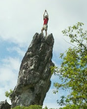
But Friday was not all about being armed to survive and sitting around. No, it was about getting into the wilderness and hitting the trails. And that is exactly what Joy and I did, we climbed Mt. Monadnock.
We started out at the Park Ranger office, elevation 1400', sunny, and 70 degrees. It was a beautiful day to climb to the summit of Monadnock (3165'). We took the White Dot Trail up and down, which is the most direct route to the summit, being about 1.9 mi one way. It was not too hot, and we hardly sweat. The fact that Joy and I had started exercising regularly after the wedding really helped us out. We were able to make it up to the summit in an hour and 20 mins, and back down in the same amount of time (only stopping here and there for a few mins). At the summit it was 66 degrees and windy and fairly clear. From here, you can see clearly in all directions (supposedly over 100 miles), which gives you a vista of NY, MA, and VT. Supposedly, on a clear day you can see the skyscrapers in Boston.
For those of you who have never hiked Monadnock before, you climb up almost 1800 feet and it is not all easy going the entire way. There is a fair amount of rock climbing, not like technical climbing, but spots where you must use your hands and feet to get up. Well most people need to use their hands. I always ascend no hands, which can be done with a bit of skill if you are tall. (Does this come from always riding roller coasters no hands?) That being said, the average hiker makes it up in a little under 2 hours, but it is fairly obtainable for most people and has a wonderful view to reward you at the top.
So it was a fairly smooth hike and I was able to test out the aforementioned Suunto Vector's elevation measuring aspects. According to the watch, it was 3220 ft at the top...off by 50 feet, less than 2%, which is not bad considering I never calibrated it at the beginning of the hike. A word about altimeters on watches-no matter what brand you buy, they always have to be calibrated at known elevation points, because they measure elevation by air pressure, which changes the higher you rise. The thing is, air pressure is always changing, depending on a million different things, including temperature (which they explain in the manual), but nonetheless, it is fairly accurate, all things considered, and is very helpful in figuring out how much more you have to go, cross-referencing with topo maps etc. (Now if you bought the GPS model for $500 your elevation would be spot on accurate AND you would have GPS coordinates, but this watch was expensive enough) Also, by the watch, our rates for ascending/descending were between 0 and 27 ft/second. Just another interesting measurement to figure out how much longer it will take to get down. (The Vector can also tell you the average rate for a particular time period if you ask it, say the entire hike, it automatically records your elevation for the past 24 hours (same with the barometric readings), or it can log it and save it for future reference. And it keeps track of all your highs and lows, like highest elevation, most elevation gain, etc.)
Needless to say, I was very impressed with the watch's first real action and will definitely make good use of it on my Washington summit this weekend.
Enough about the watch.
Back to me sucking at survival skills. We are camping, and that means we need a fire to cook our hot dogs and smores over. Honestly, I'm really not sure where Smokey the Bear gets off telling people about forest fires and how dangerous they are and always remember to put out your fire etc, because I can't even make a fire when I'm trying to make a fire. Dry wood, check. Lighter, check. Firepit, check. Tinder, plenty-check. Fire? No. How about now? No. How about 30 mins later? Yes. Wow that is hard work. Smokey the bear indeed.
After dinner I take over the world.
The entire world in a night, sounds like Santa Clause, but its just Michael Thomas and global domination.
I'm talking about RISK of course.
Exhausted from taking over the world, I head to bed with Joy in our 40 degree rated sleeping bags. Wow is it cold. Rated down to 40 degrees? It is chilllllllly. We make it to sleep. I wake up in the middle of the night and check my watch, it reports that its 52 degrees. 52!! Considering our apartment has been in the 80's when we usually sleep, that is a big difference. A 30 degree difference!! Good thing I had a warm body to cuddle up to...

No comments:
Post a Comment